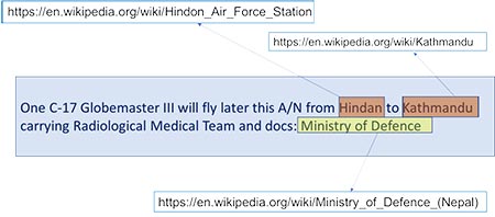
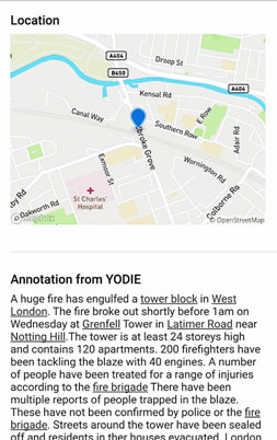
In the large volumes of messages circulating on social media and the internet about a disaster, one of the critical things we need to know is the location of things, events and actions, meaning who is doing what and where.
Which village is flooded? Where are the people who need help? The YODIE tool finds mentions of people, organisations and places in documents, enabling them to be matched to relevant database entries for greater context. If the entry exists in Wikipedia, it also finds the correct one (there might be more than one place with the same name). This not only gives users more information about the place, but also can potentially produce the exact coordinates, so that the location can be plotted on a map. YODIE has been integrated into the COMRADES platform, so that when posts are submitted to the platform via social media or the mobile app, additional information can be identified about important entities. For locations, this means that users and emergency responders can easily see exactly where the action or information is taking place.


